

Proprietary Technology

Compressive Seismic Acquisition & Reconstruction (CS-A / CS-R)
Compressive Sensing (CS) is a modern approach to efficiently collecting seismic data in the field, capable of reducing the number of sources and receivers needed to acquire high-quality data and/or enhancing the data with no additional sources/receivers. We use a fully optimized numerical solver to ensure that our CS surveys are perfectly designed to handle obstacles and permit holes while producing the best possible image.

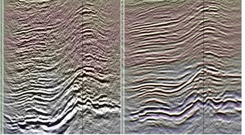
Bin Reduction and EPOCS Recon for Legacy Surveys
EPOCS (Extended Projection onto Convex Sets) is a fast and powerful reconstruction algorithm which can regularize survey grids, deblend simultaneous-source data, and fill missing traces. A superior alternative to 5D Interpolation, EPOCS can take advantage of Compressive Sensing principles even for off the shelf, legacy datasets. Our EPOCS Bin Reduction can enhance the resolution of seismic images to their natural limits.

Least Squares Q Prestack Depth Migration (LS-QPSDM)
By combining the strengths of Least-Squares and Q-Migration, we can obtain a high-fidelity, low-noise solution with the strong amplitudes of a Q-Migration and the low noise content of a Least-Squares solution. We can apply this Least-Squares Q approach to any variant of Prestack Depth Migration (e.g. Kirchhoff, Beam, RTM) to ensure the best possible result in regions with complex structure and inconsistent illumination.
Full Waveform Inversion (FWI) Imaging
Full-Waveform Inversion (FWI) is a sophisticated, modern seismic imaging and velocity modeling approach that has overtaken Reverse-Time Migration (RTM) as the premier method for high-resolution, high-fidelity subsurface imaging. We apply an innovative K-Tomo / Elastic FWI workflow to create a final velocity model, then calculate the reflectivity series and apply an iterative inversion scheme to produce a final FWI image.

K-Semblance & K-Tomography
Semblance is a measure of the similarity or “likeness” of seismic traces. Semblance-based Tomography has been widely used for decades as a means of velocity modeling for depth imaging. In-Depth innovates upon conventional tomography using our proprietary K-Semblance and K-Tomo, which uses the dip field to account for dipping geology when calculating trace similarity. This makes the resulting tomography converge to a more reliable result with fewer iterations.
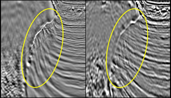
Point-Spread Function (PSF) Imaging
We use a powerful new imaging approach to mitigate artifacts around complex geology by treating each subsurface ray as traveling through its own unique lens, modeling the resulting PSF, and deconvolving the final image in the 5D VOT/VAT domain to produce a result free of the associated artifacts and distortions. This technique is particularly useful in regions with complex geology, such as salt bodies.
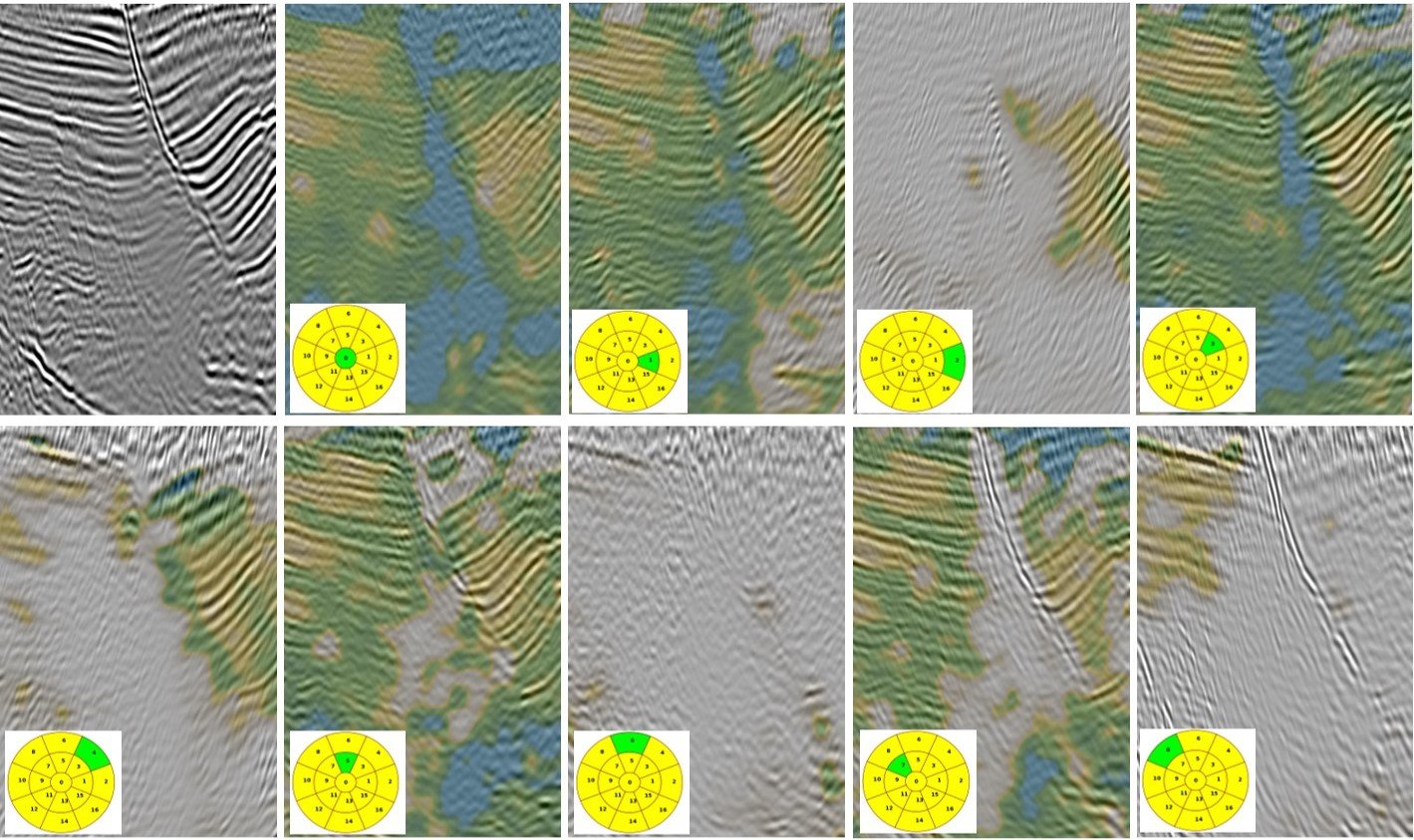
Vector Offset/Angle Tiling (VOT/VAT)
Rather than relying on angle stacks alone for detailed interpretation, we decompose data into tile stacks based on inline and crossline offset (VOT) or subsurface reflection angle and azimuth (VAT). We can then manually or algorithmically customize the weighting of each of these tiles to produce a fully-tailored final stack, cutting out noisy regions and enhancing signal. This leads to significant improvement in the final stack, especially around complex geology with salt bodies and faults.

Spatially Adaptive Multiple Attenuation (SAMA)
Our latest demultiple technology, Spatially Adaptive Multiple Attenuation (SAMA), improves upon pre-existing predict-and-subtract methods by adding two additional layers of adaptive multiple modeling prior to least-squares subtraction. The SAMA technique produces a cleaner result with fewer remaining multiples while protecting key primary reflectors.